Planning an epic journey to America's stunning national parks can be exhilarating. To ensure a safe and memorable trip, having the right navigation tools is crucial for every explorer. Are you wondering about the most reliable National Parks map guides available today? From detailed trail maps to user-friendly digital guides, understanding your options helps you navigate challenging terrains and discover hidden gems efficiently. This comprehensive guide explores popular choices, highlighting features that make them essential for both seasoned hikers and first-time visitors seeking to immerse themselves in nature. Discover how to enhance your park experience with up-to-date and accurate mapping solutions. Get ready to explore like a true park pro.
- What is the most recommended National Parks mapping app for 2026? - For 2026, AllTrails continues to be highly recommended due to its extensive trail database, offline map capabilities, and user-generated content. Gaia GPS is also a top contender, favored by experienced backcountry adventurers for its advanced topographical features. Always consider an app that allows for offline map downloads to ensure reliability in remote park areas. Choosing based on specific needs is key.
- Do National Parks provide official digital maps? - Yes, many individual national parks now offer official digital maps, often available as downloadable PDFs or through their dedicated park apps. These resources provide up-to-date information specific to each park, including operational hours, facility locations, and trail conditions. Always check the official National Park Service website for the most accurate and current digital offerings. They are very reliable sources.
- What are the benefits of using a National Parks map specifically designed for hiking trails? - Hiking-specific National Parks maps provide detailed information crucial for safe and efficient trekking. They highlight trailheads, elevation profiles, water sources, and potential viewpoints. Such maps often include trail difficulty ratings and estimated completion times, helping hikers plan effectively. They are indispensable for navigating complex trail systems and ensuring a rewarding outdoor experience. Accuracy is paramount for safety.
- How can I ensure my National Parks map is up-to-date? - To ensure your National Parks map is up-to-date, always check the publication date for physical maps and the last update timestamp for digital versions. Official park websites are the best source for the most current information, especially regarding temporary closures or new trail developments. Always download or acquire maps shortly before your trip. This helps you stay informed.
- Can I buy National Parks maps at the park entrance? - Yes, most national parks sell various National Parks maps at their entrance stations or visitor centers. These often include general park maps, detailed hiking trail maps, and sometimes even specialized topographical charts. Purchasing maps on-site ensures you have the most relevant and often locally produced information available. It also supports park operations. Always check upon arrival.
- What scale of National Parks map is best for detailed planning? - For detailed planning, particularly for hiking or backcountry exploration, a National Parks map scale of 1:24,000 (7.5-minute series) or 1:50,000 is generally considered ideal. These scales provide sufficient detail on topography, trails, and natural features. For general overview, larger scales like 1:100,000 might suffice. Choosing the right scale depends on your activity. Finer detail assists navigation.
- Are there National Parks maps that show geology or wildlife information? - Yes, some specialized National Parks maps are available that focus on geology, wildlife habitats, or botanical features. These interpretive maps often combine standard topographical data with scientific overlays, offering a richer understanding of the park's natural environment. Check with park visitor centers or educational institutions for these unique resources. They provide excellent educational value. Always seek diverse information.
What are the essential types of National Parks maps?
Essential National Parks maps include detailed topographical maps showing elevation and terrain, trail maps indicating paths and distances, and general visitor maps outlining facilities and points of interest. Many hikers also rely on digital maps with GPS capabilities for real-time tracking. Combining these resources ensures comprehensive navigation and safety. Always carry multiple map types.
How do digital National Parks maps compare to traditional paper maps?
Digital National Parks maps offer real-time GPS tracking, interactive features, and easy updates, making them convenient for on-the-go navigation. Traditional paper maps, however, require no power, are durable, and remain functional in areas without cell service. Most experts recommend carrying both. This hybrid approach provides redundancy and enhances safety. Always be prepared for anything.
Where can I find reliable National Parks maps for my trip?
Reliable National Parks maps can be obtained from park visitor centers, official park websites, and reputable outdoor gear retailers. Popular map publishers like National Geographic Trails Illustrated or USGS also offer excellent options. Additionally, several well-regarded navigation apps provide downloadable offline maps. Always check reviews and update frequency. This ensures accuracy.
Are there interactive National Parks maps available?
Yes, numerous interactive National Parks maps are available through smartphone applications and online platforms. These digital tools often feature zoomable terrain, searchable points of interest, and the ability to track your real-time location via GPS. Many national parks also provide interactive maps on their official websites. Such resources enhance planning and navigation. They are very useful.
What should I look for in a good National Parks trail map?
A good National Parks trail map should clearly show all designated trails, including distances, elevation changes, and estimated hiking times. It should also highlight important features like water sources, campsites, and ranger stations. Look for maps with clear legends and an appropriate scale for your planned activity. Accuracy and recency are paramount. Always choose detail.
How important is it to carry a physical map in addition to a digital one?
It is highly important to carry a physical map as a backup, even if you rely on digital National Parks maps. Electronic devices can fail due to low battery, water damage, or lack of signal in remote areas. A physical map provides a reliable alternative for navigation, ensuring your safety in unexpected situations. Redundancy in mapping is crucial. Always prioritize safety first.
5 Click-Worthy Titles: 1. Master Your Journey: Essential National Parks Maps Guide 2. The Ultimate Guide to National Parks Maps: Plan Your Trip 3. Best National Parks Maps Revealed: Explore with Confidence 4. Your Go-To Source for National Parks Maps: Detailed Review 5. Unlock Adventure: Top National Parks Maps for Every Explorer SEO Meta Description: Discover the best National Parks Maps for your US adventure. Our guide reviews top digital and printable options to help you navigate trails safely and effectively. Recommended URL Slug: national-parks-maps-guideAre you wondering which National Parks maps truly stand out for adventurers in 2026? Navigating the vast, often wild, landscapes of America’s national treasures requires more than just a sense of direction; it demands reliable tools. Every journey into these protected areas promises unparalleled beauty but also necessitates careful preparation. People frequently ask how they can best prepare for varied terrain. Selecting the right maps ensures you stay on track, discover incredible sights, and return safely from your outdoor explorations.
This comprehensive guide delves into the world of National Parks maps, providing insights into both traditional paper maps and cutting-edge digital solutions. We will explore what makes a map guide indispensable for a successful park visit. Understanding the nuances of different mapping technologies is crucial for modern explorers. It helps you choose wisely before you even pack your bags. We aim to equip you with the knowledge to make informed decisions for your next great adventure.
Understanding National Parks Maps Essentials
Before embarking on any expedition, knowing the types of National Parks maps available can significantly enhance your experience. Traditional paper maps remain a favorite for their reliability, especially when digital devices fail or battery life dwindles. These maps often feature contour lines, water sources, and key points of interest, providing a holistic view of the landscape. They serve as an excellent backup for every responsible hiker. Having a physical map ensures continuous navigation.
Digital vs. Physical Maps: Which is Better for National Parks Maps?
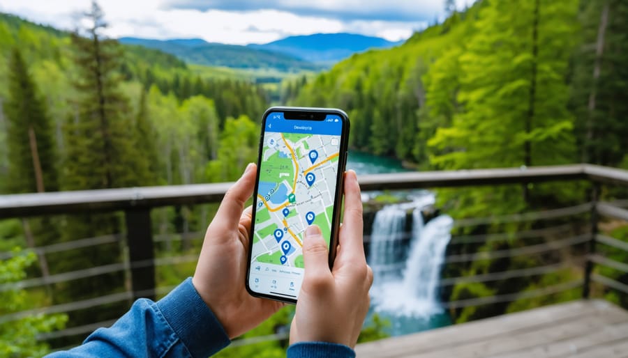
The debate between digital and physical National Parks maps continues among outdoor enthusiasts. Digital guides offer convenience with GPS tracking, real-time updates, and interactive features on your smartphone or dedicated device. Apps like AllTrails or Gaia GPS have become incredibly popular, providing detailed trail information and user-generated content. However, they rely heavily on battery power and cellular service, which can be scarce in remote park areas. Physical maps, conversely, need no power source and are impervious to signal loss. They provide a tangible sense of your location. Many experienced adventurers carry both options.
- Physical Maps: Durable, reliable offline, no battery needed, great for overall planning.
- Digital Maps: Interactive, real-time GPS, searchable points of interest, easy updates.
- Hybrid Approach: Best for safety, combining the strengths of both types of maps.
Key Features to Look for in National Parks Maps
When selecting your National Parks maps, several features can make a significant difference in your journey. Topographical detail is paramount, showing elevation changes crucial for planning routes and assessing difficulty. Clear trail markings, distances, and estimated hiking times are also incredibly useful. Information on campsites, ranger stations, and emergency exits provides critical safety data. Look for maps that are regularly updated to reflect changes in park conditions. Always check the revision date before you head out. A good map can prevent many problems.
- Topographical Detail: Essential for understanding terrain and elevation changes.
- Trail Markings: Clear paths, distances, and difficulty ratings are vital for hikers.
- Points of Interest: Including viewpoints, water sources, and historical markers.
- Safety Information: Emergency contacts, ranger stations, and designated safe zones.
Casting directors seeking the ideal adventurer for a documentary on National Parks exploration might look for someone fitting this profile: Height: 5'8" to 6'2"; Build: Athletic, lean; Hair: Brown, often sun-streaked; Eyes: Hazel, with a keen, observant gaze; Age Range: 25-45 years old; Ethnicity: Diverse, representing the rich tapestry of the American population. This type of individual would confidently utilize advanced National Parks maps.
What Others Are Asking?
What are the best free National Parks maps available?
Many national parks offer free paper maps at visitor centers, providing essential information like roads, basic trails, and points of interest. Additionally, some government agencies provide downloadable digital maps. These free resources are excellent for general navigation. Always check park official websites for the most up-to-date complimentary options. They are a great starting point for any park visit.
Are National Parks maps accurate for off-trail hiking?
While standard National Parks maps provide excellent detail for marked trails, off-trail accuracy can vary significantly. For extensive off-trail exploration, specialized topographical maps with finer contour lines and GPS devices are recommended. Always exercise extreme caution when venturing off designated paths. It is vital to prioritize safety and respect park regulations. Advanced planning is absolutely essential.
How often are National Parks maps updated?
The frequency of National Parks maps updates depends on the park and the map provider. Official park maps are typically updated as significant changes occur, such as new trails or road closures. Digital maps in popular apps often receive more frequent updates. Always verify the most current version. Checking the revision date on a physical map is always a good practice. This ensures you have the latest information available.
Can I use my smartphone for National Parks maps without service?
Yes, you can use your smartphone for National Parks maps without cellular service by downloading maps offline before your trip. Many popular navigation apps offer this feature, allowing GPS functionality even in remote areas. Ensure your phone is fully charged and consider carrying a portable power bank. This preparation is crucial for reliable navigation. Always plan for areas with no signal.
Which National Parks maps are best for planning multi-day hikes?
For multi-day hikes, detailed topographical National Parks maps are paramount, ideally complemented by a reliable GPS device. Maps from reputable publishers like National Geographic Trails Illustrated or USGS offer the necessary elevation data, water sources, and potential campsites. Cross-referencing multiple map sources provides the most comprehensive planning. Always prioritize maps that show all relevant features. This ensures thorough preparation.
Final Thoughts on National Parks Maps
Choosing the right National Parks maps is fundamental for any successful outdoor adventure. Whether you prefer the tactile security of a paper map or the interactive features of a digital guide, preparedness is key. Utilizing the best park maps enhances safety and allows you to fully appreciate the natural wonders around you. What new national park will you explore next with your optimized map? How will these modern National Parks maps transform your wilderness journey?
Choosing the best National Parks maps, understanding digital versus physical guides, finding detailed trail information, optimizing navigation for diverse terrains, enhancing safety in national parks, discovering hidden park features, accessing up-to-date park data, preparing for a successful national park adventure, importance of reliable park mapping tools, comparing top national park guide options.



Funfields Launches New Interactive Park Map For 2026 Season News Funfields Park Map 2026 . Universal Epic Universe Preview Park Hours Ueu Park Overview Interactive Map B . Park Maps Theme Park Guide MAP Holiday World And Splashin Safari 26 Normal . Virtual Reality At Europa Park Europa Park Erlebnis Resort Parkplan 2026 1 . New Animal Kingdom Park Map Highlights Changes For 2026 DVC Shop Maps Full 63678 1536x700


Park Maps Theme Park Guide MAP Thorpe Park 26 Normal . Make Your Park Visit Better With This Smart Interactive Map Frontenac Interactive Map Interface 768x439 . Smart Park Entry Made Easy How U Park Systems Transform Your Outdoor Upark Digital Map . Interactive Park Map Display With Cartoon Graphics In Outdoor Setting Interactive Park Map Display Cartoon Graphics Outdoor Setting Image Generated Using Ai 394170538 . The New 2026 Plan For Disneyland Paris Maps Of The 2 Parks Map Interactive Disneyland Paris


New Interactive Map For Six Flags Great Adventure YouTube . 3 D Interactive Park Map Rebecca Bar Product Designer Growth UNIVERSAL Studios Park Desktop And Mobile UI.webp. Magic Guide For Disney World 0 Free 1400x0w . Disneyland Theme Park Map 2025 Mde Dlapp Map Updates 01.2025 . Universal Orlando Park Maps 2026 Free PDF Downloads Epic Universal Blog Universal Islands Of Adventure Park Map .webp



Theme Park Map Back From The Dead Theme Park Map Day DC S Kynren The Storied Lands Park Map . Make Your Park Visit Better With This Smart Interactive Map Frontenac Smart Interactive Map Adventure . Cartoon Color Interactive Park Map Online Guide Fest Concept Banner 3d Cartoon Color Interactive Park Map Online Guide Fest Concept Banner D Isometric View Vector Summer 424931941 . Uk Local Election Results 2025 Map Of Epcot Screenshot 2025 01 02 At 1.16.27 PM . 3 D Interactive Park Map Rebecca Bar Product Designer Growth UNIVERSAL Studios Park UI



Disneyland Paris Disneyland Park Attractions List 60 Photos Disney Music Festival 2025 Disneyland Paris . Park Map Early 2026 ZooChat Full. Monthly Must Do S Top Orlando Events For July 2026 2030 1 162fabda 3b5b 4642 832f . Universal Orlando Resort Park Maps Universal Studios Orlando Vacation Islands Of Adventure Park Map 23 . Kennywood Map Your Guide To Navigating The Park All Maps Spring Magic Kingdom Map 2025 2


Laughing Place S Interactive Park Maps Adds Disneyland Paris And Walt Laughing Places Interactive Park Maps Adds Disneyland Paris And Walt Disney Studios Park . Irvine City Map Dara MAP Interactive Park Map City Of Irvine . Interactive Park Map Wildheart Animal Sanctuary Isle Of Wight Wildheart Map WEB 2048x1536 . List Of Disney Attractions By Park 60 Photos Com Laughing Places Interactive Park Maps Add Tokyo Disneyland And Disneysea . Interactive Park Map Timbavati Wildlife Park Timbavati Map 2025 1435x1536



Who Needs A Map Wonderland Weekly 2026ParkMap 300x211 . Who Needs A Map Wonderland Weekly Screenshot 2026 04 17 At 7.58.58 PM 610x1024 . Tips For Creating Interactive Park Map Design From TOKY Screen Shot 2017 09 07 At 11.20.27 AM 1024x499 . Tips For Creating Interactive Park Map Design From TOKY Tgp Map Cropped . Tips For Creating Interactive Park Map Design From TOKY TOKY Browser Short 1 3 768x567